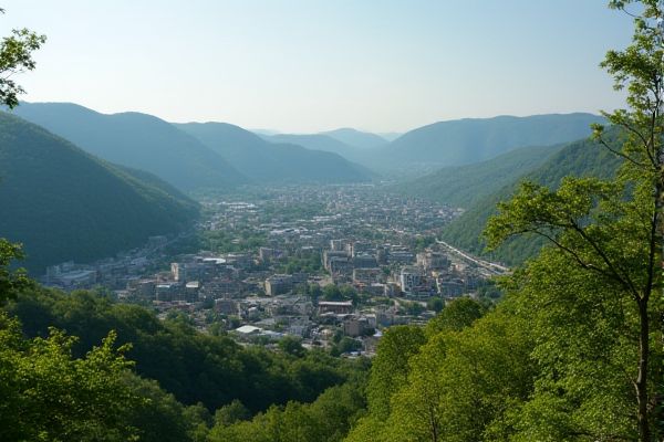
Weather and climate in West Virginia: Humid subtropical and continental climate regions. Four distinct seasonal changes. Hot, humid summers. Mild to cold winters. Frequent precipitation year-round. Occasional thunderstorms and tornadoes. Snowfall varies by region. Elevation affects temperature and weather. Fall foliage attracts tourists. Flooding risks in certain areas.
Humid subtropical and continental climate regions
West Virginia has a Humid Continental Climate, except for the eastern panhandle which benefits from a marine modification. The state's climate varies significantly with elevation, with the southwestern region experiencing a more subtropical climate characterized by hot and humid summers and mild winters, while the rest of the state, especially at higher elevations, has colder winters and cooler summers. For more detailed insights, visit the Britannica page.
Four distinct seasonal changes
West Virginia experiences four distinct seasons: spring (March to May) with mild temperatures and scenic outdoors; summer (June to August) characterized by humid and warm weather; fall (September to November) with pleasant temperatures and vibrant foliage; and winter (December to February) marked by cold temperatures and significant snowfall, especially in higher elevations. For detailed information about the best time to visit West Virginia, you can explore the comprehensive guide on the Holidify website.
Hot, humid summers
West Virginia experiences hot and humid summers, with July high temperatures averaging from the lower 70s in the mountains to the upper 80s in the southwestern lowlands and Eastern Panhandle, accompanied by overnight lows in the mid-50s to mid-60s. The region is also known for its common early morning fog from July through September. For more detailed information, you can visit the WV Encyclopedia, which provides an extensive overview of West Virginia's climate and weather patterns.
Mild to cold winters
West Virginia experiences mild to cold winters, with average temperatures ranging from 26°F (-4°C) near the Cheat River to 41°F (5°C) along the border with Kentucky. The state receives significant snowfall in higher elevation areas, making it popular for winter sports. For more detailed climate insights, you can visit the West Virginia Climate page. This diverse climate underscores the state's appeal for those seeking winter outdoor activities.
Frequent precipitation year-round
West Virginia experiences frequent precipitation year-round, with an average of 45 inches of rain and 33 inches of snow annually. Precipitation is distributed across the year, though autumn is the wettest season and spring is the driest, with some areas receiving over 60 inches of precipitation due to orographic lifting, while others in the rain shadow receive significantly less. For more detailed insights into the climate of West Virginia, you can explore comprehensive data and seasonal trends.
Occasional thunderstorms and tornadoes
West Virginia experiences occasional thunderstorms and tornadoes, with 2024 marking a record year for tornadoes, largely due to improved reporting from increased use of security cameras, cell phones, and social media. Tornadoes in the state are most common between April and July, and while they are relatively uncommon, they can cause significant damage and loss. To learn more about this significant weather pattern, visit the West Virginia Watch for comprehensive insights. This ongoing weather event underscores the importance of staying informed and preparing for extreme conditions despite their rarity.
Snowfall varies by region
Snowfall in West Virginia varies significantly by region, ranging from about 20 inches in the river valleys of the southwestern lowlands to over 125 inches in elevations above 2,500 feet in the northern and central mountains. For example, Snowshoe in the central mountains averages 144.7 inches of snow annually, while Clarksburg in the northwest averages only 23.8 inches. For more detailed statistics and information, you can visit the West Virginia Annual Snowfall page.
Elevation affects temperature and weather
Elevation in West Virginia significantly influences temperature and weather, with higher elevations moderating summer temperatures and resulting in lower maximum temperatures, ranging from around 85°F in the southwest to less than 80°F in the east-central mountains. The state's rugged topography also leads to varied climate conditions, including significant snowfall in mountainous areas and a rain shadow effect in the Eastern Panhandle.
Fall foliage attracts tourists
West Virginia's fall foliage attracts tourists with peak colors expected in different regions from late September to early November, starting in the Mountain Lakes Region and progressing through the Potomac Highlands, Mid-Ohio and Greenbrier valleys, and finally the Metro Valley and other areas.
Flooding risks in certain areas
West Virginia is expected to experience increased flooding risks due to climate change, with the state ranking second for flood risk among the lower 48 states. Cities like Charleston have the highest overall risk, and areas are projected to see more frequent and intense precipitation events, particularly during winter and spring, leading to greater flood risks. For more information on this topic, you can visit the website Climate Check, which provides valuable insights into West Virginia's climate challenges.
